Within 37 African countries, UNESCO (United Nations Educational, Scientific and Cultural Organization) has listed 135 World Heritage Sites within the continent. South Africa has eight designated official sites, uKhahlamba Drakensberg Park - (KwaZulu-Natal), Mapungubwe National Park - (Limpopo), Cape Floral Region - (Western Cape) Vredefort Dome - (Free State), Richtersveld Cultural and Botanical Landscape - (Northern Cape), iSimangaliso Wetland Park - (KwaZulu-Natal), Robben Island - (Western Cape), and Cradle of Humankind - (Gauteng)
This article uses images from the Wikipedia article "List of World Heritage Sites in Africa", which is released under the Creative Commons Attribution-Share-Alike License 3.0.
| Heritage Site | Description |
|---|---|
| Aapravasi Ghat (Port Louis District,Mauritius)
|
Aapravasi Ghat was the first site chosen by the British government to take part in the "Great Experiment", where indentured laborers were used instead of slaves. Between 1834 and 1920, almost half a million contracted workers passed through Port Louis from India, either to work in Mauritius or to transfer to other British colonies. |
| Abu Mena (Abusir,Egypt)
|
The ruins of the former Christian holy city contain a church, a baptistery, basilicas, public buildings, streets, monasteries, houses, and workshops, and were built over the tomb of Menas of Alexandria. The World Heritage Committee designated Abu Mena as an endangered site in 2001, due to cave-ins in the area caused by the clay at the surface, which becomes semi-liquid when met with "excess water". |
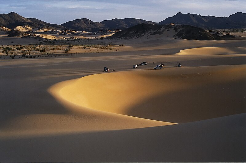
| Air and Ténéré Natural Reserves (Arlit Department,Niger)
|
Africa's largest protected area, located in the Saharan desert of Ténéré, consists of the volcanic rock mass of AÁ¯r and a small isolated Sahelian pocket with unique flora and fauna. The natural reserve was placed on UNESCO's List of World Heritage in Danger in 1992, due to the increase in military conflicts and the hostage-taking of six reserve staff in February. Removal from this list was considered in 1999, but as of 2011, its position remains unchanged. |
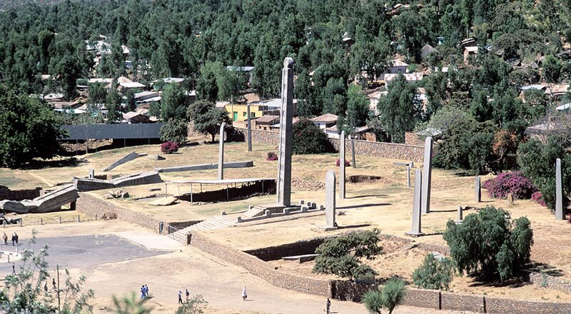
| Aksum (Tigray Region, Ethiopia)
|
The ruins of the city of Aksum, dating from the 1st to the 13th century, mark the heart of ancient Ethiopia and what was the "most powerful state between the Eastern Roman Empire and Persia". It includes monolithic obelisks, giant stelae, royal tombs, and ruins of former castles. |
| Al Qal'a of Beni Hammad (Maadid, Algeria)
|
The fortified first capital of the Hammadid emirs was originally built in 1007 and demolished in 1152. It features an 8-bay, 13-aisle mosque, which is one of the largest in Algeria. |
| Aldabra Atoll (Aldabra Group, Seychelles)
|
The Aldabra Atoll consists of four large coral islands and a lagoon, surrounded by a coral reef. The islands are home to the world's largest population of giant tortoises. /td> |
| Amphitheatre of El Jem (El Djem, Tunisia)
|
The Amphitheatre of El Jem, built during the 3rd century, is North Africa's largest amphitheatre with a capacity of 35,000 spectators, and "illustrates the grandeur and extent of Imperial Rome." |
| Ancient Ksour of Ouadane, Chinguetti, Tichitt and Oualata (Ouadane, Chinguetti, Tichitt and Oualata, Mauritania)
|
"Founded in the 11th and 12th centuries to serve the caravans crossing the Sahara, these trading and religious centres became focal points of Islamic culture. [...] Typically, houses with patios crowd along narrow streets around a mosque with a square minaret. They illustrate a traditional way of life centred on the nomadic culture of the people of the western Sahara." |
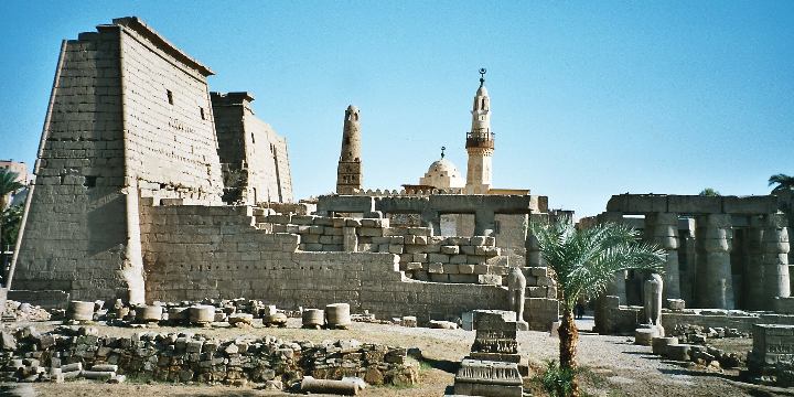
| Ancient Thebes withn its Necropolis (Qena, Egypt)
|
The former capital of Egypt and city of the Egyptian god Amun contains relics from the height of Ancient Egypt . The temples, palaces and the necropolises of the Valley of the Kings and the Valley of the Queens bear "a striking testimony to Egyptian civilization." |
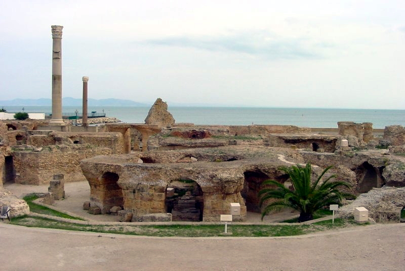
| Archaeological Site of Carthage (Tunis, Tunisia)
|
Founded in the 9th century BCE, Carthage was developed into a trading empire spanning the Mediterranean , and was, according to UNESCO, "home to a brilliant civilization." The city was destroyed in 146 BCE in the Punic Wars at the hands of the Romans, but was later rebuilt by these. |
| Archaeological Site of Cyrene (Jebel Akhdar, Libya)
|
The formerly Greek colony was Romanized and transformed into a capital, until it was destroyed by an earthquake in 365. The thousand-year-old ruins have remained renowned since the 18th century. |
| Archaeological Site of Leptis Magna (Khoms, Libya)
|
The Roman city of Leptis Magna was enlarged by Emperor Septimius Severus, who was born there. Public monuments, a harbour, a marketplace, storehouses, shops, and homes were among the reasons for its induction into the list. |
| Archaeological Site of Sabratha (Sabratha, Libya)
|
"A Phoenician trading-post that served as an outlet for the products of the African hinterland, Sabratha was part of the short-lived Numidian Kingdom of Massinissa before being Romanized and rebuilt in the 2nd and 3rd centuries." |
| Archaeological Site of Volubilis (Meknes, Morocco)
|
The important Roman outpost of Volubilis was founded in the 3rd century BCE to become the capital of Mauritania. It contained many buildings, the remains of which have survived extensively to this day. |
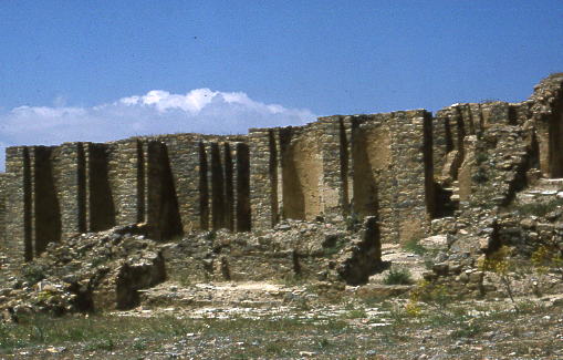
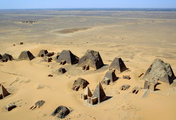
| Archaeological Sites of the Island of Mero (Meroë, Sudan)
|
The site was the centre of the Kingdom of Kush, a major force active from the 8th century BCE to the 4th century CE. It is home to pyramids, temples, and domestic buildings, among other vestiges. |
| Asante Traditional Buildings (Kumasi, Ghana)
|
The site, north-east of Kumasi, hosts the final intact remains of the Ashanti Empire, which peaked in the 18th century. The dwellings, which are made of earth, wood, and straw, are susceptible to the damages caused by the "onslaught of time and weather." |
| Asmara (Eritrea)
|
Located at over 2000 metres above sea level, the capital of Eritrea developed from the 1890s onwards as a military outpost for the Italian colonial power. After 1935, Asmara underwent a large scale programme of construction applying the Italian rationalist idiom of the time to governmental edifices, residential and commercial buildings, churches, mosques, synagogues, cinemas, hotels, etc |
| Barberton Makhonjwa Mountains (South Africa) |
The mountains contain the world’s oldest geological structures and are known to have preserved volcanic and sedimentary rocks estimated to be between 3.6 to 3.25 billion years old. |
| Banc d'Arguin National Park (Azefal and Nouadhibou, Mauritania)
|
The park consists of sand dunes, coastal swamps, small islands, and shallow bodies of water; all bordering the coast of the Atlantic Ocean. Birds are often found to migrate in the area, accompanied by various species of sea turtles and dolphins, whose presence fishermen often use to attract fish. |
| Bassari Country (Bassari and Bedik Cultural Landscapes, Senegal)
|
|
| Bwindi Impenetrable National Park (Kabale District, Kisoro District and Rukungiri District, Uganda)
|
Located on the border of plain and mountain forests, the park in south-western Uganda is home to over 160 species of trees, over a hundred species of ferns, and various species of birds and butterflies. Many endangered species are within its boundaries as well, including the mountain gorilla |
| Cape Floral Region Protected Areas (Eastern Cape and Western Cape, South Africa)
|
The site consists of eight protected areas that are among the richest in plant life worldwide, containing nearly 20% of Africa's total flora. Its scientific value is demonstrated by the presence of fire and radiation adaptivity in plants and seed dispersal by insects. |
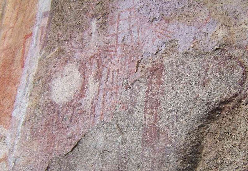
| Chongoni Rock Art Area (Dedza Distric, Malawi)
|
The 127-site area contains the richest concentration of rock art in Central Africa, ranging from Stone Age paintings to contemporary work from farmers. The symbols depicted in the rock art are strongly centred around women, and retain a cultural significance for the Chewa. |
| Cidade Velha, Historic Centre of Ribeira Grande (Ribeira Grande, Cape Verde)
|
The town, south of the island of Santiago, was the first European colonial outpost in the tropics, with remains dating back to the 16th century. Two churches, a royal fortress, and Pillary Square help comprise the tropical town's original street layout. |
| Cliff of Bandiagara (Land of the Dogons) (Bandiagara Cercle, Mali)
|
The sandy plateau and cliffs of Bandiagara outline the site, featuring houses, granaries, altars, sanctuaries, and Togu-Na meeting-places. Age-old social traditions such as masks, feasts, rituals, and ancestral worship also add to its cultural significance. |
| Comoé National Park (Zanzan, CÁ´te d'Ivoire)
|
Among the largest protected sites of West Africa, the park features the Comoé River and the unique flora which accompanies it. The site was placed on UNESCO's List of World Heritage in Danger in 2003, due to unrest in CÁ´te d'Ivoire, and various other factors such as poaching overgrazing. |
| Dja Faunal Reserve (Dja-et-Lobo and Haut-Nyong, Cameroon)
|
Among Africa's largest and best protected rain forests, the Cameroonian reserve is almost completely surrounded by the Dja River and contains 107 mammal species, of which five are threatened. |
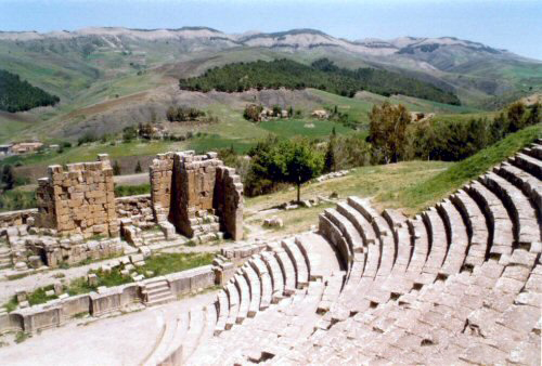
| Djémila (Sétif, Algeria)
|
The ruins of a Roman town in a mountainous location, including a forum, temples, basilicas, triumphal arches and houses, each adapted to a location 900m above sea level. |
| Djoudj National Bird Sanctuary (Saint-Louis Region, Senegal)
|
The Senegal River delta wetland area consists of streams, lakes, ponds and backwaters. It is the home to 1.5 million birds, including the great white pelican, the purple heron, the African spoonbill, the great egret, and cormorants. The sanctuary also features crocodiles, African manatees, and other typical Sahelian species. |
| Dougga / Thugga (Béja Governorate, Tunisia)
|
The site features the ruins of Dougga, a former capital of a Libyan – Punic state, which flourished under Ancient Rome and the Byzantine Empire, but declined in the Islamic period. |
| Ecosystem and Relict Cultural Landscape of Lopé-Okanda (Ogooué-Ivindo and Ogooué-Lolo, Gabon)
|
The park features well-preserved tropical rain forests and savanna, resulting in a diverse ecosystem consisting of endangered, large mammals. |
| Fasil Ghebbi, Gondar Region (Amhara Region, Ethiopia)
|
The fortress was the residence of the Ethiopian emperors during the 16th and 17th century. The city remains, which feature buildings with Hindu and Arabinfluences, were later remodelled with Baroque-style architecture by Jesuit missionaries. |
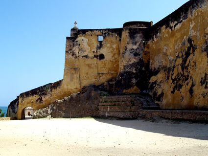
| Fort Jesus (Mombasa, Kenya)
|
Fort Jesus is a Portuguese fort built from 1593 to 1596 on Mombasa Island to guard the old port of Mombasa, Kenya. The site's layout follows the Renaissance ideal that the human body is perfectly proportionate. |
| Forts and Castles, Volta, Greater Accra, Central and Western Regions (Central Region, Greater Accra, Volta Region, and Western Region, Ghana)
|
The site features the remains of fortified trading posts, built along the Ghanaian coast between 1482 and 1786. |
| Fossil Hominid Sites of Sterkfontein, Swartkrans, Kromdraai, and Environs (Gauteng, Limpopo and North West, South Africa)
|
The various fossil sites contain traces of human occupation and evolution dating 3.3 million years. |
| Garajonay National Park (La Gomera, Spain)
|
Most of the park, in the middle of the island of La Gomera of the Canary Islands, is covered with a lush laurel forest. |
| Garamba National Park (Orientale, Democratic Republic of the Congo)
|
The park has vast savannas, grasslands and woodland, featuring elephants, giraffes, hippopotamuses and the white rhinoceros. Garamba was deemed to be endangered following the diminution of the white rhinoceros population in the area, but it was removed from the list in 1991. However, it later regained the status in 1996, when three rangers were killed and the population of white rhinoceros fell once again. |
| Gebel Barkal and the Sites of the Napatan Region (Meroë, Sudan)
|
The five sites in the Nile Valley feature temples that are testimonial to the Napatan and Meroitic cultures. |
| Gough and Inaccessible Islands (Saint Helena, United Kingdom)
|
The site represent one of the least-disrupted islands and marine ecosystems in the North Temperate Zone. The cliffs are free of introduced mammals and feature one of the world's largest colonies of seabirds. |
| Great Zimbabwe National Monument (Masvingo Province, Zimbabwe)  |
The city, now in ruins, was an important trading center between the 11th and 15th centuries, and was capital of the Bantu civilization. |
| Harar Jugol, the Fortified Historic Town (Harari Region, Ethiopia)  |
The city is on a plateau and surrounded by gorges and savanna. It contains 82 mosques, 102 shrines, and unique interior design in the townhouses. It is said to be the fourth-holiest city of Islam. |
| Historic Cairo (Cairo, Egypt)  |
One of the world's oldest Islamic cities and in the middle of urban Cairo, the site dates from the 10th century and reached its golden age in the 14th century. It contains mosques, madrasah, hammams and fountains. |
| Historic Centre of Agadez (Tchirozerine Department, Niger)  |
|
| Historic City of Meknes (Meknes, Morocco)  |
The former capital was founded in the 11th century and turned into a city with Spanish-Moorish influence during the 17th and 18th centuries. |
| Historic Town of Grand-Bassam (Sud-Comoé, CÁ´te d'Ivoire)  |
A colonial town built during the 19th and 20th centuries, Grand-Bassam was the first Ivorian capital following French rule in the region. Its quarters, which specialised in commerce, administration and general housing, helped the city become the economic and judicial hub of the country, in addition to being its most important port. |
| Ichkeul National Park (Bizerte, Tunisia)  |
Ichkeul Lake and the surrounding wetlands is a destination for hundreds of thousands of migrating birds, including ducks, geese, storks and pink flamingos. It was once part of a chain that extended across North Africa. |
| iSimangaliso Wetland Park (KwaZulu-Natal, South Africa)  |
The park features a variety of landforms, including coral reefs, long sandy beaches, coastal dunes, lake systems, and papyrus wetland, caused by fluvial, marine and aeolian processes. |
| Island of Gorée (Dakar Region, Senegal)  |
The island was the largest slave-trading center on the African coast from the 15th to the 19th century. |
| Island of Mozambique (Nampula, Mozambique)  |
The fortified former Portuguese trading post has used the same architectural techniques, style, and materials since the 16th century. |
| Island of Saint-Louis (Saint-Louis Region, Senegal)  |
The French colonial settlement from the 17th century is on an island in the mouth of the Sénégal River. It played an important role in the culture and economy of West Africa. |
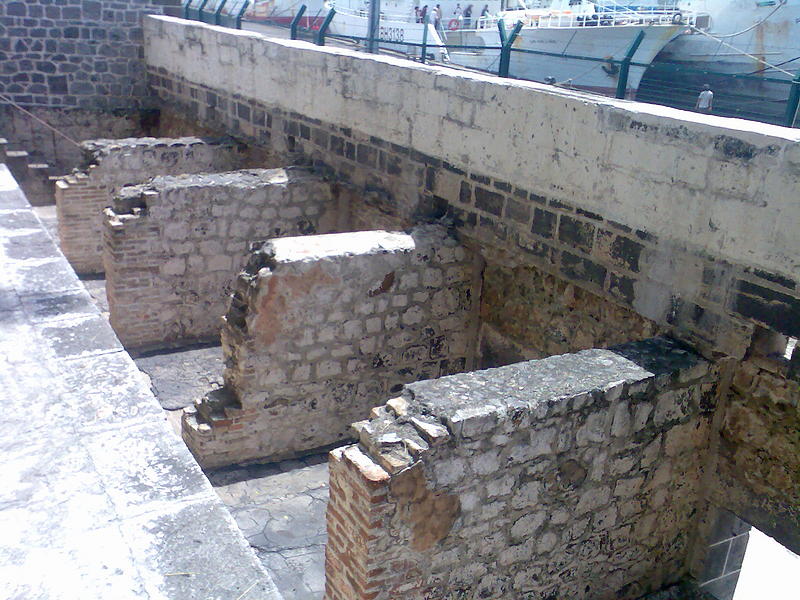
| James Island and Related Sites (Banjul,Lower Niumi and Upper Niumi, Gambia)  |
The site is a testimony to the encounters between Africa and Europe from pre-colonial times to independence along the Gambia River<. |
| Kahuzi-Biega National Park (Maniema and South Kivu, Democratic Republic of the Congo)  |
The park is dominated by two extinct volcanoes, Kahuzi and Biega. It also has abundant fauna, including the graueria gorillas. The park was deemed to be endangered in 1997 when deforestation and hunting became a major problem. Militia groups and illegal settlers were also settling in the park, while fire and poaching helped justify the World Heritage Committee's decision. |
| Kairouan (Kairouan Governorate, Tunisia)  |
The former capital was founded in 670 and flourished in the 9th century. Its heritage includes the Mosque of Uqba and the Mosque of the Three Gates. |
| Kasbah of Algiers (Algiers, Algeria)  |
A unique Islamic city on the Mediterranean coast, the former site overlooks the Carthaginian trading posts of the 4th century BCE. It contains remains of a citadel, old mosques, and Ottoman -style palaces. |
| Khami Ruins National Monument (Matabeleland, Zimbabwe)  |
The city was built after the mid-16th century and was an important trading center. |
| Kilimanjaro National Park (Kilimanjaro Region, Tanzania, United Republic of)  |
The volcanic massif Mount Kilimanjaro is Africa's highest point at 5,895 >metres, and is surrounded by a park with savanna and forest featuring numerous mammals. |
| Kondoa Rock Art Sites (Kondoa District, Tanzania, United Republic of)  |
Two millennia of rock carving, many of high artistic value, have been found at 150 shelters in the site. They tell the tale of socio-economic development from hunter-gatherer to agro-pastoralism. |
| Konso Cultural Landscape (Southern Nations, Nationalities, and People's Region, Ethiopia)  |
The site features 55 kilometres of stonewalled terraces and fortified settlements in the Konso highlands of Ethiopia. |
| Koutammakou, the Land of the Batammariba (Kara Region, Togo)  |
The Batammariba's mud tower houses have become a symbol of Togo. They range up to two stories and feature spherical granaries. |
| Ksar of Ait-Ben-Haddo (AÁ¯t Benhaddou, Morocco)  |
The ksar is an example of a traditional pre-Saharan habitat, surrounded by high walls and reinforced with corner towers. |
| Lake Malawi National Park (Central Region and Southern Region, Malawi)  |
Lake Malawi contains hundreds of fish species, mostly endemic. |
| Lakes of Ounianga (Ennedi Region, Chad) |
The Lakes of Ounianga are a series of 18 lakes located in the Sahara desert, in North-Eastern Chad. They exhibit a variety of sizes, depths, chemical compositions and colorations, and some of them are home to aquatic fauna. |
| Lake Turkana National Parks (Lake Turkana, Kenya)  |
Turkana, as Africa's largest saline lake, is an important area for the study of fauna and flora. It is a breeding ground for the Nile crocodile, hippopotamus and several venomous snakes. |
| Lake System in the Great Rift Valley (Rift Valley Provinc, Kenya)  |
Located in the Great Rift Valley, Kenya, the site features three lakes: Lake Bogoria, Lake Nakuru and Lake Elementaita. A highly diverse population of birds, including thirteen threatened species, frequent the area. |
| Lamu Old Town (Lamu, Kenya)  |
The town is the oldest Swahili settlement, and is built in coral stone and mangrove timber. It features inner courtyards, verandas, and elaborate wooden doors. |
| Laurisilva of Madeira (Madeira, Portugal)  |
The site is the largest surviving area of laurel forest. It consists of approximately 90% old-growth forest and is home to endemic species such as the Madeiran long-toed pigeon. |
| Le Morne Cultural Landscape (Rivière Noire District, Mauritius)  |
The rugged mountain that juts into the ocean was used as a shelter by runaway slaves through the 18th and early 19th centuries. They formed small settlements in the caves and on its summit. |
| Lower Valley of the Awash (Afar Region, Ethiopia)  |
Palaentological findings from at least four million years ago, such as Lucy, give evidence of human evolution. |
| Lower Valley of the Omo (Southern Nations, Nationalities, and People's Region, Ethiopia)  |
The prehistoric site near Lake Turkana is the location of many fossil findings, such asHomo gracilis. |
| M'Zab Valley (GhardaÁ¯a, Algeria)  |
The intact, traditional human habitat was built around five ksour in the 10th century by the Ibadites. |
| Maloti-Drakensberg Park (Qacha's Nek District, Lesotho, KwaZulu-Natal, South Africa)  |
The park features incisive dramatic cutbacks, golden sandstone ramparts, and the largest concentration of cave art in Sub-Saharan Africa. |
| Mana Pools National Park, Sapi and Chewore Safari Areas (Matabeleland North, Zimbabwe)  |
The park, located on the banks of the Zambezi River, features a variety of wild animals, such as buffalo, leopards, cheetahs and Nile crocodiles. |
| Manovo-Gounda St. Floris National Park (Bamingui-Bangoran, Central African Republic)  |
The park features vast savannas with a wealth of flora and fauna, such as black rhinoceros, elephants, cheetahs, leopards, wild dogs, red-fronted gazelles and buffalo. |
| Mapungubwe Cultural Landscape (Limpopo, South Africa)  |
The open savanna landscape lies at the confluence of the Limpopo and Shashe Rivers. It was the heart of theMapungubwe Kingdom until the 14th century, when the area was abandoned, leaving untouched remains of palaces and settlements. |
| Matobo Hills (Matabeleland South, Zimbabwe)  |
The large boulders have been used as natural shelters since the early Stone Age and feature a collection of rock paintings. |
| Medina of Essaouira (formerly Mogador) (Essaouira, Morocco)  |
The fortified seaport built during the late 18th century has a mix of North African and European architecture, and was a major trading hub between the Sahara and Europe. |
| Medina of Fez (Fez, Morocco)  |
The former capital was founded in the 9th century and features the world's oldest university. The urban fabric and main monuments date from the 13th and 14th centuries. |
| Medina of Marrakesh (Marrakesh, Morocco)  |
The town was founded in the 1070s and remained a political, economic, and cultural centre for a long time. Monuments from that period include the Koutoubia Mosque, the kasbah, and the battlements. The city also holds newer features, including palaces. |
| Medina of Sousse (Sousse Governorate, Tunisia)  |
A prime example of a town from the early Islamic period, the city was an important port during the 9th century. |
| Medina of Tétouan (formerly known as Titawin) (Tétouan, Morocco)  |
Morocco's most complete medina served as the main point of contact between Morocco and Andalusia during the 8th century. The town was rebuilt by Andalusian refugees following the reconquista. |
| Medina of Tunis (Tunis, Tunisia)  |
The medina holds 700 monuments, including palaces, mosques, mausoleums, madrasahand fourtains, testifying to Tunis' golden age from the 12th to the 16th century. |
| Memphis and its Necropolis – the Pyramid Fields from Giza to Dahshur (Giza, Egypt)  |
The former capital features funerary monuments, like rock tombs, mastabas, temples, and pyramids. It is one of the Seven Wonders of the Ancient World. |
| Mosi-oa-Tunya / Victoria Falls (Livingstone District and Matabeleland North, Zambia and Zimbabwe)  |
The falls of the Zambezi River, which is more than 2km wide, plunge down various basalt gorges resulting in a colorful mist. |
| Mount Kenya National Park/Natural Forest (Central Province and Eastern Province, Kenya)  |
The park surrounds the 5,199m Mount Kenya and features twelve glaciers. |
| Mount Nimba Strict Nature Reserve (Lola Prefecture, CÁ´te d'Ivoire and Guinea)  |
The reserve features Mount Nimba, its slopes covered in dense forest and grassy mountain pastures. |
| Namib Sand Sea (Namibia)  |
|
| Ngorongoro Conservation Area (Arusha Region, Tanzania, United Republic of)  |
The site features a concentration of wild animals in a crater beside the active volcano Oldonyo Lengai. |
| Niokolo-Koba National Park (Kédougou Region and Tambacounda Region, Senegal)  |
The forests and savannas bordering the Gambia River have a diverse fauna, including Derby eland, chimpanzees, lions, birds, reptiles, and amphibians. |
| Nubian Monuments from Abu Simbel to Philae (Aswan, Egypt)  |
Located along the Nile, the site contains monuments such as the Temple of Ramesses IIand the Sanctuary of Isis. |
| Okapi Wildlife Reserve (Orientale, Democratic Republic of the Congo)  |
Covering a fifth of the Ituri Rainforest in the Congo River basin, the reserve contains many threatened species of primates and birds. It is inhabited by the nomadic pygmy Mbuti and Efé tribes. |
| Okavango Delta (Orientale, Botswana)  |
|
| Old Towns of Djenné (Djenné, Mali)  |
Inhabited since 250 BCE, the city was an important link in the trans-Saharan gold trade. It contains 2,000 traditional houses. |
| Old Town of Ghadamès (Ghadames, Libya)  < < |
Located in an oasis, Ghadames is one of the oldest pre-Saharan cities and represents a traditional architecture with vertical division of functions. |
| Osun-Osogbo Sacred Grove (Osogbo, Nigeria)  |
The dense forests are one of the final remnants of high forests in southern Nigeria. It is the last sacred grove of the Yoruba culture. |
| Pitons, Cirques and Remparts of Reunion Island (La Réunion, France)  |
Outstanding terrain and biodiversity, as part of La Réunion National Park. |
| Portuguese City of Mazagan (El Jadida) (El Jadida, Morocco)  |
The fortification, akin to Renaissance military design from the early 16th century, was taken over by Morocco in 1769. Surviving buildings include the cistern and a Gothic church. |
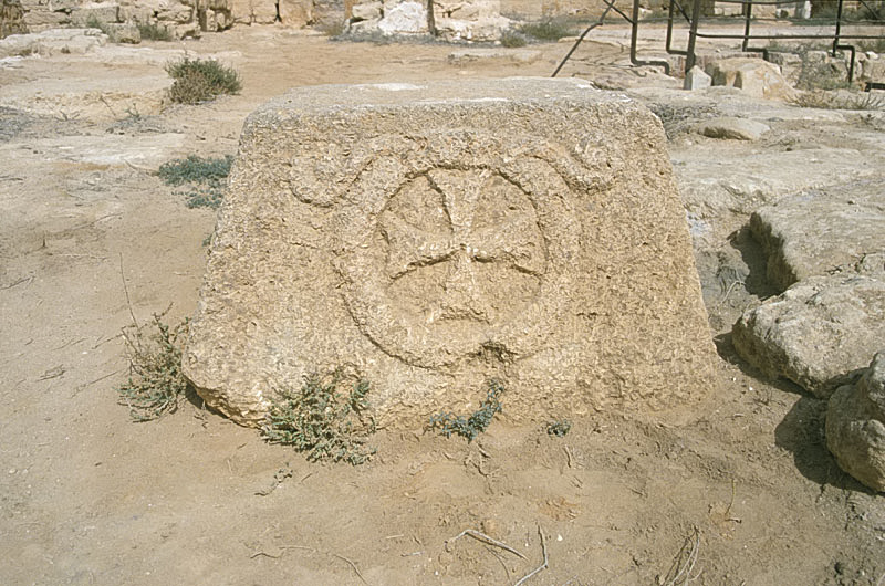
| Punic Town of Kerkuane and its Necropolis (Nabeul Governorate, Tunisia)  |
The city was abandoned in 250 BCE during the First Punic War, and is the only surviving example of a Phoenicio–Punic settlement. |
| Rabat, modern capital and historic city (Rabat-Salé-Zemmour-Zaer, Morocco)  |
Rebuilt under the direction of the French from 1912 to the 1930s, the city blends historic and modern features, such as botanical gardens, the Hassan Mosque, and the remnants of Moorish and Andalusian settlements from the 17th century. |
| Rainforests of the Atsinanana (Eastern Madagascar, Madagascar)  |
The site consists of six national parks, and protects the island's unique biodiversity, which has evolved in isolation for 60 million years. |
| Richtersveld Cultural and Botanical Landscape (Northern Cape, South Africa)  |
The mountainous desert sustains the semi-nomadic livelihood of the Nama, which includes seasonal migrations that have gone unchanged for two millennia. |
| Robben Island (Western Cape, South Africa)  |
Between the 17th and 20th century, the island was used as a prison, including for political prisoners, a hospital for socially unacceptable groups, and a military base. |
| Rock-Art Sites of Tadrart Acacus (Fezzan, Libya)  |
Thousands of cave paintings are visible in different styles, dating from 12,000 BCE to 100 CE. |
| Rock-Hewn Churches, Lalibela (Amhara Region, Ethiopia)  |
The site contains eleven medieval cave churches from the 13th century. |
| Royal Hill of Ambohimanga (Antananarivo, Madagascar)  |
The royal city and burial site is a spiritual and sacred site which has created strong feelings of national identity for several centuries. |
| Royal Palaces of Abomey (Zou Department, Benin)  |
The city held the seat of twelve kings who ruled the Kingdom of Dahomey between 1625 and 1900. All but one king built their palace within the area. |
| Ruins of Kilwa Kisiwani and Ruins of Songo Mnara (Kilwa District, Tanzania, United Republic of)  |
The site features the remains of two ports used extensively for trade across the Indian Ocean from the 13th and 16th century. |
| The Ruins of Loropéni (Loropéni, Burkina Faso)  |
More than a thousand years old, Loropéni is the best-preserved of ten fortresses in Lobi, which were part of about a hundred stone enclosures built during the trans-Saharan gold trade. |
| Rwenzori Mountains National Park (Bundibugyo District, Kabarole District and Kasese District, Uganda)  |
Covering most of the Rwenzori Mountains, including Mount Margherita, Africa's third-highest peak, the park features glaciers, waterfalls and lakes in an Alpine landscape. It also features various endangered species and unusual flora. |
| Sacred Mijikenda Kaya Forests (Coast Province, Kenya)  |
The site comprises eleven forests spread 200km along the coast of Kenya. They hold the remains of villages built during the 16th century by the Mijikenda, and are now considered sacred sites. |
| Saint Catherine's Monastery (South Sinai Governorate, Egypt)  |
The orthodox monastery from the 6th century is positioned near Mount Horeb where, according to the Old Testament, Moses received the Tablets of the Law. The region is sacred for Christians, Muslims and Jews. |
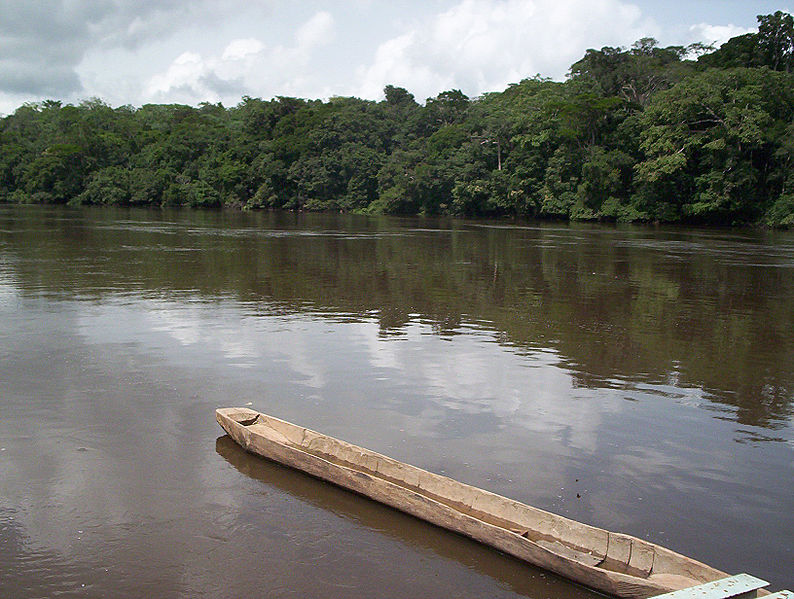
| Salonga National Park (Maniema and South Kivu, Democratic Republic of the Congo)  |
Africa's largest tropical rain forest reserve is situated at the heart of the Congo River basin and only accessible by water. It is the habitat of endangered species such as the bonobo, the Congo peafowl, the forest elephant, and the slender-snouted crocodile |
| Saloum Delta (Senegal)  |
The area has sustained human life thanks to fishing and shellfish gathering, for which there are 218 shellfish mounds across the site. |
| San Cristóbal de la Laguna (Province of Santa Cruz de Tenerife, Spain)  |
The city contains two centres: the unplanned Upper Town, and the planned Lower Town, laid out according to philosophical principals. Many of the buildings date from the 16th to the 18th centuries. |
| Sangha Trinational (Cameroon, Central African Republic and Congo) |
|
| Selous Game Reserve (Morogoro Region, Mtwara Region, Pwani Region and Ruvuma Region, Tanzania)  |
The park's vegetation varies from dense thickets to open wooded grasslands, and features large numbers of elephants, black rhinoceros, cheetahs, giraffes, hippos and crocodiles. |
| Serengeti National Park (Arusha Region, Mara Region and Shinyanga Region, Tanzania, United Republic of)  |
The vast savanna is known for the annual migration for herds of wildebeest, gazelle, zebras, and their predators. |
| Simien National Park (Amhara Region, Ethiopia)  |
The eroded Ethiopian plateau comprises jagged mountain peaks, deep valleys, and sharp precipices dropping about 1,500m. |
| Stone Circles of Senegambia (Central River Division and Kaolack Region, Gambia and Senegal)  |
The groups of stone circles are among over 1,000 different monuments along the Gambia River. Used as burial grounds, they were erected between the 3rd century BCE and the 16th century CE. |
| Stone Town of Zanzibar (Zanzibar, Tanzania, United Republic of)  |
A prime example of an East African coastal trading town, its urban fabric and townscape remains intact. |
| Sukur Cultural Landscape (Madagali, Nigeria)  |
The site features the Palace of the Hidi, terraced fields, and the remains of a former iron industry. |
| TaÁ¯ National Park (Guiglo and Sassandra, CÁ´te d'Ivoire)  |
One of few remaining sections of the West African tropical forest, the park features a rich flora, including eleven species of monkeys. |
| Tassili n'Ajjer (Illizi and Tamanrasset, Algeria)  |
The site is in a landscape with 15,000 cave engravings that record climatic changes, animal migrations, and the evolution of human life, dating from 6,000 BCE to the first centuries CE. |
| Teide National Park (Province of Santa Cruz de Tenerife, Spain)  |
The national park features the Teide stratovolcano, which at 3,718m is Spain's tallest mountain and the world's third-tallest volcano. |
| Timbuktu (Timbuktu Cercle, Mali)  |
The city was a centre for the propagation of Islam in the 15th and 16th centuries, and features three mosques and many madrasahs<. |
| Timgad (Batna Province, Algeria)  |
A military colony built by Emperor Trajan in 100 CE, the site features and decumanus streets, typical of a Roman town. |
| Tipasa (Tipaza, Algeria)  |
First a Carthaginian trading center, Tipasa was converted into a military base by the Romans. Heavy Christian influences can be seen from the 3rd and 4th centuries, though Tipasa went into steady decline in the Byzantine period. |
| Tiya (Southern Nations, Nationalities, and People's Region, Ethiopia)  |
The archaeological site contains 36 monuments, which includes 32 carved stelae covered with symbols hard to decrypt. |
| Tomb of Askia (Gao Region, Mali)  |
Built in 1495, the pyramid was built as a tomb for Emperor Askia Mohamed. It represents the power of an empire that controlled the trans-Saharan gold trade. |
| Tombs of Buganda Kings at Kasubi (Kampala District, Uganda)  |
The tombs, built after 1884, are a major example of prime architecture using organic materials, principally wood, thatch, reed, and wattle and daub. The tombs were almost completely destroyed by a fire in March 2010, prompting the World Heritage Committee to reluctantly mark the site as being in danger. The Ugandan government has since called for the reconstruction of the tombs, and UNESCO has agreed to mobilise funds for the project. |
| Tsingy de Bemaraha Strict Nature Reserve (Melaky, Madagascar)  |
The canyon of the Manambolo River comprises karstic and limestone landscapes cut into peaks and a forest of limestone needles. It also holds undisturbed forests, lakes and mangrove swamps, which are the habitat for lemurs and birds. |
| Tsodilo (North-West, Botswana)  |
The site features more than 4,500 rock art paintings in the Kalahari Desert. Archaeological records provide evidence of human and environmental activities ranging over 100,000 years. |
| Twyfelfontein or /Ui-//aes (Kunene, Namibia)  |
The site has one of the largest concentrations of rock engravings in Africa, which range from a period of over 2,000 years. |
| Vallée de Mai Nature Reserve (Praslin, Seychelles)  |
The natural palm forest is preserved in almost its original state. |
| Virunga National Park (North Kivu and Orientale, Democratic Republic of the Congo)  |
The park comprises swamps, savannas, and snowfields. Virunga was inscribed on the World Heritage Committee's List of World Heritage in Danger in 1994, due to the war in Rwanda and the subsequent increase of the refugee population in the park, deforestation, poaching, departure of park staff, and depletion of forests. |
| Vredefort Dome (Free State and North West, South Africa)  |
The crater, with a diameter of 190km, is the largest, oldest, and most deeply eroded astrobleme found on Earth, dating back more than two billion years. |
| W National Park of Niger (Say Department, Niger)  |
The park is in the zone between savanna and forest lands, and is an important ecosystem for the biogeographical area. |
| Wadi Al-Hitan (Whale Valley) (Faiyum Governorate, Egypt)  |
Located in western Egypt, the site contains fossil remains of the now extinct Archaeoceti, mapping the evolution of the whales from a land-based to an aquatic mammal. |