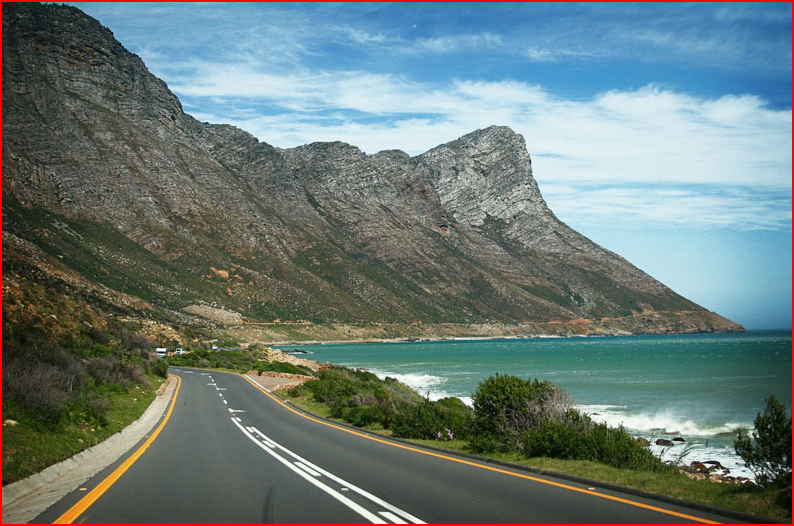
Rooi Els perches like a child's puzzle piece on the edge of Route 44, the first little seaside village after leaving Gordon's Bay, before the landmark Hangklip rock face. Rooi Els (sometimes spelt Rooiels or Rooi-Els), borders the Kogelberg Nature Reserve, forming part of the larger Kogelberg Biosphere Reserve. The smallest of these towns, Rooi Els (Red Alder) is also a registered conservancy in its own right, the beauty of the environment devotedly preserved by its residents. The town is not all that big, the roads narrow and untarred, no street lights to mar the night sky. The top end of Anemone Street acts as something of a 'town square' - the Rooi Els Grill, Eco Centre, coffee shop and café a welcome to visitors. The residential part of town winds along a couple of streets that are set closer to the shore. Homes vary from little seaside cottages to the more ostentatious beachside manor.
Rooi Els does not boast a long strip of sandy beach for its angular nature means that the little town is surrounded on three sides by water. To the east is the Rooi Els River estuary that drains into the sea after flowing under the bridge that carries Route 44, across it.
It is a beautiful beach to walk on, swim in and dive and boat from, and sunsets here are notorious. It also functions as an excellent whale watching site during winter. Birders, love Rooi Els for the endemic Cape Rockjumper, Rock Thrush and other unusual birds, and residents even claim to have seen the odd Leopard on their roads on a moonlit night. On the north bank of the Rooi Els River, roughly a kilometre from the sea, is the Rooiels Cave where Stone Age relics have been uncovered. (link provided in further reading)


