Sundays River Mouth and the beach that accompanies it are awesome reflections of the beauty of the Eastern Cape. The river itself is spectacular, and the mouth’s waters are calm and warm; ideal for swimming, fishing or just cooling one’s feet. The Sundays River Mouth is situated on the southern boundary of the world-renowned Addo Elephant National Park. The beach boasts some of the highest dunes in the country and remains relatively untouched. The hot white sand and cool river waters are just perfect, whether you are looking to have a family day in the water, a romantic picnic for two, or a sundowner after a long day. The double-decker Sundays River Ferry is the ideal way to experience the river, and promises awesome views and a few impressive bird sightings. It is said to be the fastest flowing river in the country. The Sundays River flows in a general southeasterly direction, passing the town Graaff-Reinet in the Karoo before winding its way through the Zuurberg Mountains and then past Kirkwood and Addo in the fertile Sundays River Valley.
Place record
Sundays River, Mouth and Beach
- Coordinates
- -32.8960, 24.5860
- Updated
- 21 Aug 2026
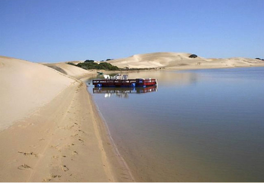
Sundays River Mouth and Beach
Location Map
Sundays River, Mouth and Beach
How we know this
- 01https://www.sa-venues.com/things-to-do/easterncape/sundays-river-mouth-beach/
Last updated · 21 Aug 2026
South African History Online. (2020, February 21). Sundays River, Mouth and Beach. South African History Online. https://sahistory.org.za/ref/P-0149988
South African History Online (2020) 'Sundays River, Mouth and Beach', South African History Online, 21 February. Available at: https://sahistory.org.za/ref/P-0149988 (Accessed: 26 October 2026).
South African History Online, Sundays River, Mouth and Beach [website], https://sahistory.org.za/ref/P-0149988, (accessed 26 October 2026).
"Sundays River, Mouth and Beach." South African History Online, 21 Feb. 2020, https://sahistory.org.za/ref/P-0149988. Accessed 26 Oct. 2026.
South African History Online. "Sundays River, Mouth and Beach." South African History Online. February 21, 2020. https://sahistory.org.za/ref/P-0149988.
Further reading
 Place
Place
Addo Elephant Game Reserve, Port Elizabeth
 Article
Port Elizabeth the Segregated city
 Place
Place
Tankwa Karoo National Park
 Place
Place
Nqweba was called Kirkwood, Eastern Cape
 Place
Place
Nelson Mandela Bay Municipality, Eastern Cape
 Place
Place
Adendorp, Eastern Cape
SAHO is free because readers fund it. Donate →