

History Grade 11 - Topic 1 Source-based Questions
General Tips when answering Source-based Questions:
- Read more about History Grade 11 - Topic 1 Source-based Questions
- Log in or register to post comments
History Grade 11 - Topic 1 Essay Questions
Explain to what extent Stalin succeeded in transforming Russia into a superpower by 1939.
- Read more about History Grade 11 - Topic 1 Essay Questions
- Log in or register to post comments
Letsemeng Local Municipality, Free State Province
The Letsemeng Local Municipality is a Category B Municipality situated in the South-Western, Free State Province within the Xhariep District. It is bordered in the North by the Lejweleputswa District, in the South by Kopanong, in the East by the Mangaung Metro, and in the West by the Northern Cape Province. It is one of three Municipalities in the District, making up almost a third of its Geographical Area. Koffiefontein is the Municipal Head Office.
The socio-economic growth of the Municipality is centered on agriculture. The Municipal Area also has mining activities, with diamond minerals being the major natural resource that helps with employment creation. It covers an Area of 9 828km².
Geolocation
23° 56' 13.2", -29° 32' 42"
History Grade 11 - Topic 1 Glossary

Extra note: In order to standardise the “Terms you need to Know” articles in the Classroom Section, all definitions are accessed from https://www.dictionary.com/browse/ . In case of a definition accessed from a different source or website, please refer to the included endnotes.
Bolshevik: When referring to a Bolshevik, one is referring to a member of the majority faction of the Russian Social Democratic Party which seized power over Russia in 1917.
- Read more about History Grade 11 - Topic 1 Glossary
- Log in or register to post comments
History Grade 11 - Topic 1 Contextual Overview

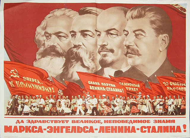
What is Communism?
- Read more about History Grade 11 - Topic 1 Contextual Overview
- Log in or register to post comments
History Classroom Grade 11 Topic 1: Communism in Russia from 1900 to 1940
Overview
Communism is a social, economic, and political ideology whose aim is to establish a communist society in which there is a collective ownership of the means of production . The goal of communism is to eliminate social classes in society...


Kopanong Local Municipality, Free Sate
The Kopanong Local Municipality is a Category B Municipality situated within the Xhariep District of the Free State Province. It is the largest of the three Municipalities in the district, making up almost half of its geographical Area. Initially the Town of Trompsburg, was the location of the Municipal Head Office. This was known as Jagersfontein Road, before the branch Railway was built, from Springfontein to Koffiefontein via Jagersfontein. Later it was named Hamilton after Sir Hamilton J. Goold-Adams, governor of the Orange River Colony from 1902 – 1910. Still later the name was changed to Trompsburg in honour of the owners of the Farm on which the Town is built.
Basic agricultural products are exported from the Area for processing and re-imported into the Area as consumer products. Historical events that took place in the Municipality, aspects of the natural and man-made environment and local activities may form the basis for promoting tourism as a significant economic activity.
Some of these events, and man-made and natural environment aspects are: ‘Lake Gariep' and the Gariep Water Festival; the Game Reserve at Lake Gariep; Jagersfontein Mine; the ‘Tiger Project' in Philippolis; the Orange River Ravine from the Gariep Dam wall to the PK le Roux Dam wall; Battlefields of significant battles conducted during the Anglo-Boer War, e.g. Mostert’s Hoek; Philippolis ‘Witblits' Festival; Historical Buildings in Philippolis, e.g. the Dutch Reformed Church, Library, old Jail, the House where Lourens van der Post was born, Adam Kok's House (the Griqua leader) and a Kraal and structure where gunpowder was kept; and Fauresmith horse endurance run.
The name is a Sesotho word meaning ‘meeting place or where people are invited'. The name earmarks unity and seeks to encourage cooperation. It includes the Towns and Cities of; Bethulie, Edenburg, Fauresmith, Gariep Dam, Jagersfontein, Philippolis, Reddersburg, Springfontein, Trompsburg, Waterkloof and so forth.
Geolocation
24° 31' 48", -29° 56' 31.2"
References
Further Reading
https://municipalities.co.za/contacts/1055/kopanong-local-municipality
https://www.nytimes.com/2002/08/03/books/master-storyteller-or-master-d…
https://adb.anu.edu.au/biography/gooldadams-sir-hamilton-john-6425
https://www.sa-venues.com/things-to-do/freestate/bysuburb/philippolis/
https://www.sa-venues.com/things-to-do/freestate/bysuburb/fauresmith/
https://www.tripadvisor.co.za/Tourism-g6676660-Reddersburg_Free_State-V…
Edenburg, near Bloemfontein
Edenburg is situated 83km South-West of Bloemfontein. This typical Transgariep Town, nestled in the golden prairies alongside the Country's busiest National road, sets its own pace as a prosperous sheep and cattle farming centre. The Town was founded on 24 February 1862 when the farm Rietfontein was purchased to built a Church and an active Berliner Missionary Station, the oldest of its kind in the Free State. At the Dutch Reformed Church, there are 19th Century Voortrekker graves. The first application for recognition as a Town was turned down by the Volksraad, but proclamation was eventually granted on 4 March 1863. Municipal status was won in 1891. The origin of the name is unclear. The most likely explanation is that it is a reference to the Garden of Eden of the Bible. However, there are those who believe that it is an Afrikaans version of Edinburgh in Scotland. Or there is a sheep and cattle ranching Farm, with this name, 'Edenburgh'. The economy of the Town and 2000 square km district is based on sheep and cattle ranching. The district is drained by the Riet River and its many small tributaries. There have been Postal Coach Tracks discovered, dating back to 21 February 1952. A variety of accommodation to suit every taste – including bed and breakfasts, chalets, caravan and camping facilities and self-catering units.
Geolocation
-29° 43' 26.4", 25° 53' 42"
References
Further Reading
Koffiefontein, Free State Province
Koffiefontein became the site for a large internment camp during World War II, with up to 2,000 Italian and German prisoners of war being held there, along with around 800 South Africans who were thought to be pro-Nazi. Prominent political figure John Vorster was among the South Africans held captive at Koffiefontein.
In the 1800's, Koffiefontein was an, 'oasis' location for transport riders traveling between the coast and the diamond fields and gold Mines, to the North. "Coffee fountain" is a reference to the strong coffee brew transport riders made, during their stopover. "Coffee fountain" involved transport riders grinding their own coffee beans (often with a spoon) and using the water of a natural spring to boil for the brew,(the first instant coffee?). Upon the discovery of diamonds near the natural Spring in 1870, a Town quickly developed at this Koffiefontein 'oasis', as prospectors began to Mine the Area, in search of high quality diamonds.
Koffiefontein's proximity to Mafikeng and Kimberley meant that it became involved in the Second Anglo-Boer War (1899-1902). Blockhouses, which served as defensive fortresses, were erected by the British in 1900 and are still standing in the twenty-first Century. The Koffiefontein district saw much military action during the Second Anglo-Boer War of 1899-1902 because it was close to the two strategic towns of Kimberley and Mafeking. After Boer forces under the command of General Brand and Commandant Hertzog attacked the town and its mine, several blockhouses were erected by the British in October 1900. The blockhouses were involved in actions in the subsequent months and at one point the Town was looted by the Boers and the people of the Town took refuge in the Mine. During the Second World War a large internment camp was opened in the town, with 2,000 Italian prisoners of war, some German prisoners of war, and some 800 South African internees, who were suspected of being pro-Nazi. Among the internees was F.C Erasmus and John Vorster who became prime minister of South Africa in 1966 and was president of the country from 1978 to 1979. The remains of murals painted by the Italian POWs can still be viewed in the Town, as can the barracks in which they were held.
In the 20th Century mining operations were suspended several times, the last time in 1980s, but diamond-bearing gravels from one volcanic pipe are once again being worked by De Beers.
Sheep farming is the main economic activity of the 1900 square km District, was proclaimed in 1963. Kalkfontein Dam (339 million cubic meters) on the Riet River, 20 km South-East of the town, was built to irrigate the Land on which the main crops are Lucerne, seed, potatoes and groundnuts. The Dam supplies water to Koffiefontein and Jacobsdal.
Geolocation
24° 58' 48", -29° 24' 7.2"