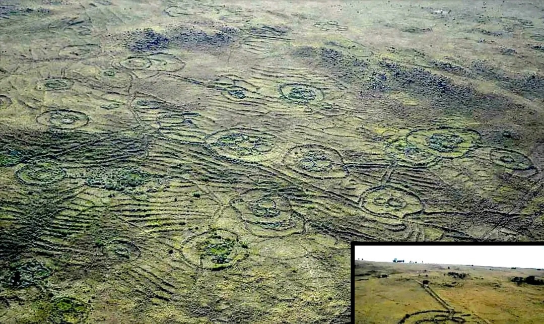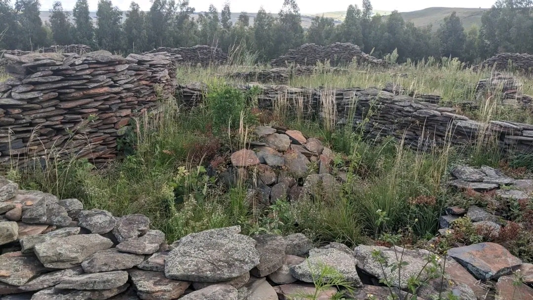
If you drive through Mpumalanga with an eye on the landscape flashing by, you may see, near the sides of the road and further away on the hills above and in the valleys below, fragments of building in stone as well as sections of stone-walling breaking the grass cover. Endless stone circles, set in bewildering mazes and linked by long stone passages, cover the landscape stretching from Ohrigstad to Carolina, connecting over 10 000 square kilometres of the escarpment into a complex web of stone-walled homesteads, terraced fields and linking roads.
Exert from: witspress.co.za/catalogue/forgotten-world
Oral traditions recorded in the early twentieth Century named the Area: 'Bokoni' – the Country of the Koni people! Most of the Mountains and Hills of Mpumalanga have stone circles on them and extensive road networks, joining them to one another, (as shown in banner). This has long been thought of as just homes, of the local peoples and their cattle Kraals. They were therefore dismissed as being of any real value or importance to Archaeology. However, it has since been proven by means of extensive investigation and discovery of artefacts, rock art and satellite and aerial imagery, that these people, the Bokoni or Koni people, were much more advanced! They were farmers, forgers of weapons and tools, miners and traders. The smelting of iron and copper and forging of weapons and tools from iron ore and mixing this with charcoal and fluxes to get steel takes a very specialized skillset, even some form of chemistry to get the mixture right for the steel to be strong enough to be of use. This later developed into a specialty performed by only specific people and the skill was then passed down within those families. The chief of the Village prized the metal-workers as the skill allowed for trade from and to other Villages and even long distance to other peoples. This even included the trade in gold, where it was found. The Archaeological site of Mapungubwe has demonstrated the use of gold, used in burials. The Bokoni also developed specialized Farming methods using terracing for their crops and walls along roadways to prevent their livestock grazing on their crops on their way to and from pasture. Crops planted were sorghum, bulrush millet, finger millet, gourds, squash, melons, beans and groundnuts. They kept cattle, goats, sheep and chickens. Their diet also consisted of some wild animals, primarily buck. Due to being attacked by various tribes, the Bokoni built walls around their Settlements and Villages. They used too position themselves on top of Mountains and Hills so that they could be more defensible. Rocks could be rolled down on attackers trying to penetrate their territory from below. Adam's Calendar is protected as part of the Blue Swallow National Heritage Site, and you will need a guide in order to explore the stones.