

Cape St Francis (Afrikaans: Kaap St Francis) is a village on a headland on the Eastern Cape coast of South Africa, in the Kouga Local Municipality. The quiet fishing settlement of Oyster Bay lies some 20 km to the west, and Humansdorp, the agricultural centre of the district, lies to the north. The larger village of St Francis Bay lies about 7 km away.
Naming and early records
The Portuguese navigator Bartolomeu Dias passed this coast in 1488 and gave the wider bay the name Golfo dos Pastores. In 1575 Manuel de Mesquita Perestrelo, a navigator and cartographer commissioned to chart the southern African coastline and record safe anchorages, surveyed the area. In his account of the coast he referred to the headland as Cape Serras and recorded that he had given the name Saint Francis to the bay lying to its east. The name Bahia de Sao Francisco attached to the bay rather than to the cape, and later became St Francis Bay. The headland itself took the name subsequently.
The coastline carries evidence of much older occupation, including Later Stone Age shell middens associated with Khoisan settlement, and tidal fish traps survive at Oyster Bay.
Seal Point Lighthouse
The stretch of coast at Cape St Francis has claimed many vessels. The Dutch East India Company ship De Noord ran aground near the cape on 16 January 1690, returning from Port Natal, and the steamship Hope was lost there on 3 November 1840. Further wrecks followed through the 1850s, 1860s and 1870s, and ten more vessels were wrecked near the cape after the light was established.
Construction of the lighthouse at Seal Point began on 17 March 1876, when Joseph Flack, a clerk of works in the Public Works Department of the Cape Colonial Government, set out the works. Flack died at Seal Point on 14 November 1876, before the work was completed, and is buried in the cemetery at Humansdorp. Stone for the tower was blasted from reefs roughly 200 metres east of the site and was cut and dressed on the spot.
The lamp was lit for the first time on 4 July 1878. At 28 metres the circular tower is the tallest masonry lighthouse on the South African coast, with a focal plane 36 metres above sea level and a range of 28 sea miles. The lighthouse was declared a National Monument on 11 May 1984. It remains operational, houses a museum, and the tower may be climbed in the company of a guide. See Cape Saint Francis Lighthouse.
Surfing and The Endless Summer
Cape St Francis is widely known for the right-hand point break filmed by Bruce Brown for his 1966 documentary The Endless Summer, in which Mike Hynson and Robert August cross a dune to find the wave unridden. The break was afterwards named Bruce's Beauties in Brown's honour. The wave had in fact been found earlier by the American surfer Dick Metz during travels between 1958 and 1961, and the discovery is often credited to Brown in error.
The exposure of the coast to swell generated by low pressure systems in the Southern Ocean makes surf a feature throughout the year, and Seals is the better known break at Cape St Francis itself. Bruce's Beauties became unreliable over subsequent decades as coastal erosion and development interrupted the natural replenishment of sand. A Long Term Coastal Protection Scheme, using rock groynes and beach nourishment, has been undertaken in an attempt to restore the sandbanks.
The village and its surroundings
Cape St Francis and St Francis Bay developed separately during the 1960s. The canal system at St Francis Bay, and the uniform architectural style of white walls and black roofs that characterises it, followed the purchase of land there in 1954 by Leighton Hulett, who laid out a planned resort settlement on the dunes.
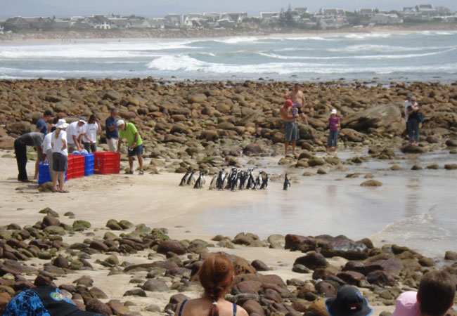
Cape St Francis remained the smaller of the two. The Irma Booysen Flora Reserve, lying between the R330 and the village, protects dune fynbos and thicket vegetation, much of it endemic to the region. The village has also been the site of a marine bird rescue and rehabilitation facility.


