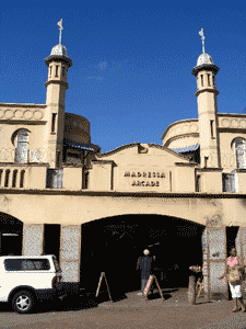
Grey Street is the teaming business and residential Indian sector of the Durban City Centre, and is also the educational, cultural and business heart of; the Natal Indian Community. The significance of the area, in the life of the South African Indian community, can be gauged from the fact that up until the late 1930's, the they formed the largest racial grouping within the Cities Municipal boundaries.
The area took its name from the main street, named after Sir George Grey, the British governor of the Cape Colony. But amongst the cities black residents it was known by many names, most commonly referred to as "Town". This is as opposed to going to West Street, which was seen as the "White section" of the city centre. While the Area was predominantly settled by Indians, it was also home to a small African and Coloured Community.
The African residents of the Area were the first to be forced to move out by the Nationalist government after the passing of the iniquitous Group Areas Act, which was one of the cornerstones of its Apartheid policies. The size of the ghetto depended on where one lived, but its boundaries were a hotly contested issue between the White City administration and its Black population, but most importantly by the City's Indian Community.
In terms of a special notice of the Group Areas Act, passed in 1950, the Nationalist government whittled down the boundaries of the area, restricting it to Indian Business use only as, extending from Commercial Road in the South to Derby Street in the North, with Field Street forming the eastern boundary and Brook and Cross Street forming the Western.