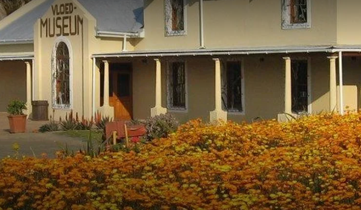
A small, modern Karoo Village, Laingsburg lies at the confluence of two rivers, but is one of the driest parts of the Country. Laingsburg is 280 km from Cape Town just off the N1 highway that travels through the Great Karoo. Despite its dryness, they are well known for the freak flood that devastated the Town on the 25 of January 1981. In a matter of Hours, the entire Town was under water, with only the roofs of Houses visible. This traumatic event was due to an abnormal rainfall in the Catchments of both the Buffel's River and Biviana's Rivers that come together in the Town. This catastrophic event claimed 104 Lives and left only 21 Buildings standing. Today high-water marks line lamp posts and the Dutch Reformed Church, one of the few remaining Buildings, to serve as a reminder, and the local Library has a collection of photographs and press cuttings covering the disaster. The Laingsburg Flood Museum is dedicated to capturing the essence of the Town and its People, and conveying the mammoth effect of this Disaster. Memorabilia, Artifacts and Information continues to be gathered for an accurate, up-to-date Exhibition that speaks to the hearts and minds of those that visit! One of the exhibitions at this Museum is; the "Wolfaardt Collection of Africana Memorabilia", which is about the Great Trek and the Anglo-Boer War and the ancient tools and implements used by the indigenous Khoi-San folk that once occupied the Region. These tell fascinating stories that are integral to the History and Heritage of South Africa, a land of so many Cultures and Customs. Laingsburg, initially called Buffelsrivier (Buffalo River), is considered something of a Geological wonderland. Running alongside its main Road are layers of fossilized mud stone and a yellow bank of volcanic ash that have blown across from South America, 250 Million Years ago. There is also a distinguishing white quartz band that runs between Matjiesfontein and Laingsburg and on into the Eastern Cape Province, indicating continental drift - a similar layer is found in South America. There is now a Geological walk on the Farm; 'Geelbeksbrug', 12 km North of Laingsburg to cater for the growing interest in the Geology of the Area. Known as the: 'Blockhouse Route', because of its proximity to the Anglo-Boer War Blockhouse, the route takes in a number of fascinating rock formations. The Area also caters extensively for outdoor enthusiasts. There are a number of Hiking Trails; including the 24 km: 'Klipkraal Route' which is along the crest of the Swartberg and the 16 km' Verlorenhoek Trail' as well as, a hike designed specially for bird fanatics at 'Kraankop Farm'. Then there’s the Annual 80 km Karoo Marathon, which passes through some of the most beautiful parts of the Area and is regarded as a rather grueling Ultra Marathon. There are several easy Mountain Bike Trails and a two-day Guided Horse Trail.
Place record
Laingsburg, Karoo
- Coordinates
- -33.1950, 20.8590
- Updated
- 21 Jul 2026
Location Map
Laingsburg, Karoo
How we know this
Last updated · 21 Jul 2026
South African History Online. (2020, April 13). Laingsburg, Karoo. South African History Online. https://sahistory.org.za/ref/P-0150161
South African History Online (2020) 'Laingsburg, Karoo', South African History Online, 13 April. Available at: https://sahistory.org.za/ref/P-0150161 (Accessed: 3 August 2026).
South African History Online, Laingsburg, Karoo [website], https://sahistory.org.za/ref/P-0150161, (accessed 3 August 2026).
"Laingsburg, Karoo." South African History Online, 13 Apr. 2020, https://sahistory.org.za/ref/P-0150161. Accessed 3 Aug. 2026.
South African History Online. "Laingsburg, Karoo." South African History Online. April 13, 2020. https://sahistory.org.za/ref/P-0150161.
Further reading
 Article
Women and Children in White Concentration Camps during the Anglo-Boer War, 1900-1902
 Article
First Anglo Boer War
 Article
The Jameson Raid
 Article
The Aftermath of the war
 Article
Role of Black people in the South African War
 Article
Black Concentration Camps during the Second Anglo-Boer War, 1900-1902
SAHO is free because readers fund it. Donate →