
Place record
RMS Athens, a Shipwreck between Moullie Point and Green Point
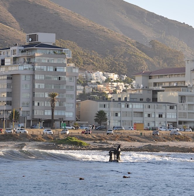
The remains of RMS Athens, which is the Engine-block, is visible in low-tide.
- Coordinates
- -33.5300, 18.2400
- Updated
- 17 Nov 2021
The remains of RMS Athens, which is the Engine-block, is visible in low-tide.
Location Map
RMS Athens, a Shipwreck between Moullie Point and Green Point
How we know this
- 01http://www.learntodivetoday.co.za/blog/2015/03/24/visible-shipwrecks-rms-athens/ https://en.wikivoyage.org/wiki/Diving_the_Cape_Peninsula_and_False_Bay/RMS_Athens https://underthebluegums.blogspot.com/2016/10/book-takeaways-shipwrecks-of-dive-sites.html
Last updated · 17 Nov 2021
South African History Online. (2021, November 17). RMS Athens, a Shipwreck between Moullie Point and Green Point. South African History Online. https://sahistory.org.za/ref/P-0151178
South African History Online (2021) 'RMS Athens, a Shipwreck between Moullie Point and Green Point', South African History Online, 17 November. Available at: https://sahistory.org.za/ref/P-0151178 (Accessed: 15 October 2026).
South African History Online, RMS Athens, a Shipwreck between Moullie Point and Green Point [website], https://sahistory.org.za/ref/P-0151178, (accessed 15 October 2026).
"RMS Athens, a Shipwreck between Moullie Point and Green Point." South African History Online, 17 Nov. 2021, https://sahistory.org.za/ref/P-0151178. Accessed 15 Oct. 2026.
South African History Online. "RMS Athens, a Shipwreck between Moullie Point and Green Point." South African History Online. November 17, 2021. https://sahistory.org.za/ref/P-0151178.
Further reading
 Place
Place
Time Ball Tower, Table Bay Harbour, Cape Town
 Place
Place
Green Point
 Place
Place
Lighthouse, Beach Road, Green Point
 Place
Place
New Somerset Hospital, Beach Road, Green Point
 Place
Place
Table Bay
 Place
Place
False Bay
SAHO is free because readers fund it. Donate →