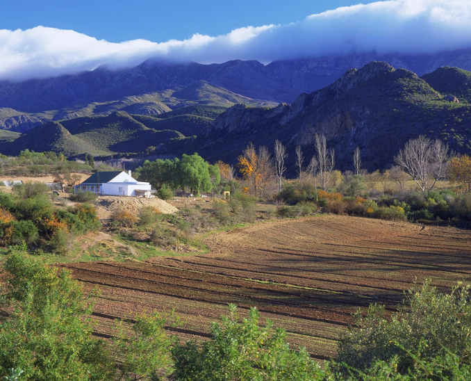
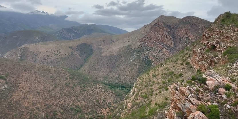
There is a Gorge that lies in the Valley, stretching for over 100 kilometres, between the Baviaanskloof Mountains to the North and the Kouga Mountains, to the South. Recently awarded World Heritage Site status, this 192 000 hectare u-shaped reserve lies about 120 kilometres west of Port Elizabeth and is named after the baboons that roam the area - a mix of the Dutch word ‘baviaan’ for baboon and the Afrikaans word ‘kloof’ for ravine. The Kouga Wilderness lies in the incredible Kouga Mountains on the edge of the Baviaanskloof, advertised as the real outdoor experience, and where you go to climb rocks, kloof, fish, watch birds, hike and adventure on, 4X4 routes.
This spectacular Kloof (which is part of the R332 route) links the Western section of the Baviaanskloof within the higher Karoo hinterland, and more specifically, the Towns of Willowmore and Uniondale,(which are standard Baviaanskloof refuelling points). The Pass needs to be driven slowly to best appreciate its dramatic, unique geology. This is a big Pass and that involves multiple River crossings - none of which are conventionally Bridged. (Should you find the first two crossings difficult or the current too strong, rather turn back as conditions get much worse the further down the Kloof you proceed!) The Pass contains 41 bends, corners and curves within it's length, which includes 1 full horseshoe bend and 10 other bends in excess of 100 degrees. The gradients are generally fairly easy and never exceed 1:12, but the road surface can vary between quite good (the road had just been graded on the day of filming) to badly corrugated and rutted and the road is also frequently damaged by floodwaters, so make your way too cross, at the river crossings.
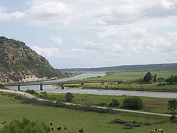
Baviaanskloof, the area, includes the Karoo towns of Willowmore and Steytlerville as well as a number of small stock farms, and the little town of Patensie lies at the start of the Gorge. The last stop, so to speak, before entering the wilderness of the Baviaanskloof. A single dirt Road, which follows the dry River Beds, where it can, taking in some of the most breathtaking Passes through Mountains along the way, was built between 1880 and 1890 by Thomas Bain. The Baviaanskloof Area, like the rest of the Eastern Cape, is a Region free from the threat of malaria. Although mosquitoes may bite one during the Night, these do not carry this illness. This makes the area ideal for families with little ones and the elderly in tow. It continues to winds its way through the Valley, with no other access, in or out. With 42 River Crossings, assisted only by causeways, all of which are liable to flood during heavy rainfall, your journey is bound to be both exciting and beautiful - an area awaiting discovery! This Land of raw wilderness, with its rocky Passes and rugged Gorges can only be travelled from East to West or from West to East. Baviaanskloof offers hours of beautiful scenery - Veld, indigenous Forests, crystal Mountain Streams, sheer Cliffs and Waterfalls, and is home to an amazing diversity of plants and species - from Yellowwoods to Karoo Bossies and Fynbos.
"The best time to visit is in Spring, before the heavy Summer rains or in Autumn before it gets too cold, and one should try to avoid Long Weekends or Holiday Seasons, if one can."