This small Town in KwaZulu-Natal was, according to district records, named in honour of: Earl Grey, who was the renowned British politician. However it would seem that the Town was actually named after: Sir George Grey. Who was the Governor of the Cape from 1854 to 1861. Prior to this, on 31 December 1853, the District residents met to name the Town, and decided on 'Pretorius' after Andries Pretorius. The Colonial Government however refused to allow this, remembering that Pretorius had borne arms against the British! A tentative name had already been fixed to the plan drawn by the surveyor and this was quickly adopted.
Greytown, just 150km from Durban, is an ideal rest-stop when travelling the Natal Midlands or Battlefield routes, (often referred to as the ‘jewel of KwaZulu Natal). Greytown lies in the Forest Area and rolling Hills of the Natal Midlands. It is a picturesque little Town which was originally settled in, during the 1850's. It was subsequently full of buildings of note. There are lots of scenic drives reflecting; Boer History. (Greytown originally enjoyed a fair amount of importance, playing ‘little elephant’ to Pietermaritzburg’s ‘place of the elephant’).
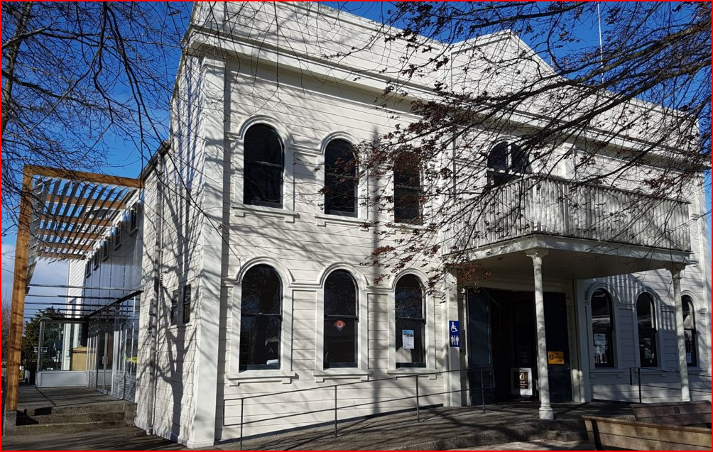
Louis Botha, the Country’s first Prime Minister and a famous Boer leader, was born on a Farm just outside of Greytown, and some believe that the Liberation Struggle for a Democratic South Africa, began in Greytown, almost a Century ago, with the Bhambatha Rebellion. This uprising against white authority by a local Zulu chief forced white residents to shelter in the Town Hall which was built in 1897. (It is worth a visit when in Greytown!) Other interesting Buildings include: 'Greytown’s Mosque' which was built in 1946 to replace the original of 1898, 'Shri Vishnu Mandir Temple'. This Temple has a Dome with the lotus flower. This symbolises spiritual life. The St James Anglican Church in Greytown, has an archway and stained glass windows originally come from England.
The Area around Greytown is awash with rolling sugar cane, pine, wattle, gum and poplar forests and the winding roads to the Muden Valley, are overlooked by a collection of aloes and euphorbia that cluster on the Hillsides. (Making this a wonderful drive!) These same Hillsides are filled with many to Bushman paintings. Where the road drops into Weenen, a cairn of stones was placed by early Zulu travellers who passed here, for good luck.


