

Southern Cape
This region includes the Garden Route, the Central Karoo, and the Eastern part of the Overberg. A very distinct Area made up by contrasting Regions with each having a unique Character, Nature, Culture and History. This is home to the Indigenous Khoi and San people; the first meeting took place in Mossel Bay circa 1488 between European and ancient man. Swellendam was founded in 1745 and George not long after that, officially anyway. Pioneers and big game hunters, started to explore Areas of the Overberg, Oudtshoorn and George since the mid-17th Century. The Southern Cape and Karoo includes the Southernmost point of the African Continent, rain Forests, Mountains, sandy Beaches, proteas, fynbos, semi-Desert, fruit trees, Agricultural Land, Waterfalls, Nature Reserves, wildlife and plenty of ostriches,"(these animals are what makes the Karoo legendary!)" The Southern Cape and Karoo are not a Province but part of the; Western Cape Province, of South Africa. This Area occupy's the South Eastern, part of the Province. Previously the Western Cape Province used to be much bigger than now. Historically the Central Karoo and Southern Cape did occupy the entire Southern and Central Geographical part of the Western Cape Province, hence the name the Southern Cape.
The Garden Route is made up of the following Local Municipalities:'Hessequa; Kannaland; Mossel Bay; Oudtshoorn; George; Knysna and Bitou. As there is a better climate and richer soil quality. The majority of the Population is concentrated on the Coastal Belt and from there; the Population becomes sparser towards the interior. The Central Karoo is made up of the following local Municipalities: Laingsburg; Prince Albert; and Beaufort West. The Overberg is made up of the following local Municipalities: Cape Agulhas and Swellendam.
Geolocation
-33° 52' 37.2", 16° 54"
Mkumeni Location, Flagstaff
The Ingquza Hill Local Municipality (previously the Qaukeni Local Municipality) is a Category B Municipality located within the OR Tambo District in the Eastern Cape Province.
It is bordered by the Ntabankulu and Winnie Madikizela-Mandela Local Municipalities to the North, and Port St Johns Local Municipality and the Indian Ocean to the South. Ingquza Hill is one of the five Municipalities in the District, accounting for almost a quarter of its Geographical Area.
A Population Census, as defined by the United Nations is: “The total process of collecting, compiling, evaluating, analysing and publishing or otherwise disseminating demographic, economic and social data pertaining, at a specified time, to all persons in a country or a well-defined part of the country”.
The four essential features of the census are:
• individual enumeration
• universality within the agreed territorial boundaries
• simultaneity: conducted at the same time for all persons, and
• defined periodicity
A population census is the most complex and massive exercise a national statistical office undertakes. It requires mapping the entire country, mobilising and training a huge number of enumerators, conducting a comprehensive publicity campaign, canvassing all households to participate, collecting individual information, compiling vast amounts of completed questionnaires, and analysing and disseminating the data. For many people, the census may be the only time that the state reaches them and asks them a question.
A population census is typically held every five years, but because of a lack of capacity within Statistics South Africa, it was decided that the interval will be extended to 10 years. A Community Survey was conducted in the place of the 2006 census. (the link can be read in FURTHER READING)
As you can deduct from the numbers. There are a fair number of Educational Facilities available in the Ares. (also, FURTHER READING)
Geolocation
-31° 4' 22.8", 29° 29' 6"
References
Further Reading
https://www.cogta.gov.za/cgta_2016/wp-content/uploads/2020/11/INGQUZA-H…
https://www.citypopulation.de/en/southafrica/easterncape/
https://schoolsdigest.co.za/listings/mkumeni-junior-primary-school/
https://www.schools4sa.co.za/phase/primary-school/eastern-cape/flagstaf…
https://www.sahistory.org.za/place/eastern-cape
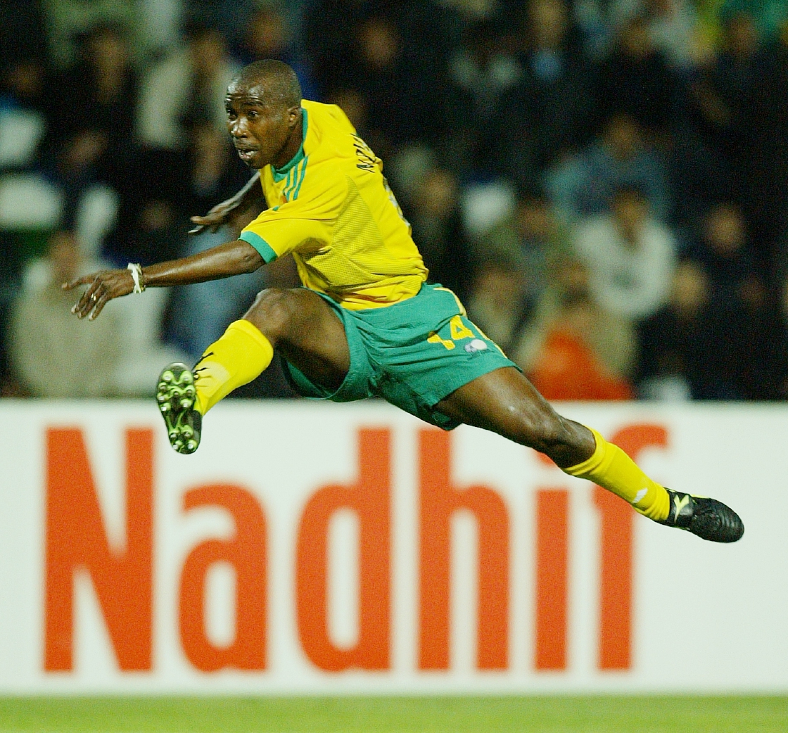
Siyabonga “Bhele” Nomvethe
Siyabonga "Bhele" Nomvethe, from kwaMashu, Durban, Natal (now Kwazulu Natal) was born on 2 December 1977.
His carrer began in primary school in kwaMashu, where he played for Claremont Blizzard and Sabatha FC, the amateur clubs that saw him make his way to Johannesburg where he began his professional career.
Lady Grey, Eastern Cape
Before 1856, Farmers in this Area attended the Church in Aliwal North. Primitive transport, bad Roads, Rivers and other obstacles made it an ordeal to go to; Church. After approval by the Church Board of Aliwal North, it was decided to purchase the Farm Waaihoek from the Botha brothers for the establishment of a new congregation. The Governor, Sir George Grey, also gave permission to name the place after his wife, “Lady Grey”. The Land surveyor, Mr. Orpen measured the Farm as well as the first 150 Erven. The first Church, completed in 1860, was built on a Hillock in the middle of Lady Grey. (It is interesting to note that all the houses were built to face the Church.)
The Reverend from Aliwal North conducted a service in Lady Grey once a month. In 1863 Rev. David Ross from Scotland accepted a call from the congregation of Lady Grey. When he arrived, Lady Grey consisted of a Church, Parsonage, two Shops and a few Houses. Rev. Ross was a learned, multi-skilled man and he used his Land Surveyor’s chain to measure more erven, in Lady Grey.
The first Hotel was on Erf 213 and it belonged to Mr. Lee. This Building was demolished, in 1865. He had offered the building and surrounding Property to the newly established Commission of Managers of the School, to use as a School and Teachers Residence. (This was in exchange for the free education of his own children. This was accepted.)
The first teacher was Mr. Reeder's. The first old Magistrates Court was also a Post Office with the Goal (Jail) on the opposite side of the same Erf. It was Built in 1889 and evacuated in 1923 when the current Magistrates and Post Office Building was completed. Lady Grey became a Municipality- SENQU Local Municipality, nbsp;in 1893 with Mr. B.J. Brummer as the first Mayor.
Before the Anglo Boer War there were no poor White people in Lady Grey. During the War, Black people were paid well in service of the British and after the War they had more than enough to keep them going without having to work. White people, destitute after the war, moved to Lady Grey and started to work as laborers. These people established themselves on the outskirts of Town. Businesses did well during the War and many Buildings were erected just after the War. The Railway between Lady Grey and Aliwal North was completed in 1905. Lady Grey became an important Trading Centre. People crossed the Mountains from Lesotho to purchase goods in Lady Grey. Large Trading Stores sold almost anything including: saddles; wallpaper; haberdashery; food and sweets. There were three Hotels: 'the Poplar Hotel; Central Hotel (currently 'Ye Olde Praktijkt') and the Commercial Hotel (currently: Mountain View Country Inn History).'
The Church of England and Methodist Church was Built in 1906 and the Dutch Reformed Church was demolished in 1911, then re-built and completed in 1913. The building that Houses the Lady Grey Arts Academy was Built in 1926 and named the 'David Ross School' after Rev David Ross. The Lady Grey Dam, also known as the Reservoir or “Groot Dam” was completed in 1925. This now has been used for Renewable Water. (FURTHER READING IS THE LINK) From the 1960’s the Town experienced an Economic decline and reached an all-time low in the mid 1990’s when the 'David Ross School', dropped to Primary School status. The changeover of the School to an Arts Academy brought revival to Lady Grey again. As the Academy grew people saw the potential of Lady Grey and started to invest in Property and Businesses. Old buildings were bought and Restored and Lady Grey became the sought after destination of today!
Geolocation
-30° 42' 41.9731", 27° 12' 43.8583"
References
Further Reading
https://www.ladygrey.co.za/
https://www.senqu.gov.za/history-lady-grey/
https://www.ladygrey.co.za/hospitality-mountain-view-boutique-hotel/
https://restaurantguru.com/Ye-Old-Praktijkt-Lady-Grey
https://www.ladygrey.co.za/hospitality-mountain-view-boutique-hotel/mou…
https://web.facebook.com/p/Lady-Grey-Arts-Academy-100063789000443/?_rdc…
https://route56.co.za/about.html
https://www.sahistory.org.za/place/lesotho
https://sahris.sahra.org.za/sites/default/files/heritagereports/AIA%5BP…
Oviston Nature Reserve, Eastern Cape
The Oviston Nature Reserve lies is on the, Southern side of the Gariep Dam. The Reserve has an Area of 16 000 Hectares. This Dam, which is the largest Dam in South Africa, is situated in a gorge at the entrance to Ruigte Valley on the Orange River in quaternary catchment D35KE, upstream of Vanderkloof Dam (the second largest Dam in South Africa). It is a combined gravity and arch Dam built entirely of concrete. However, only the central part of the wall is arched because the Gorge at the Dam is too wide to allow a complete arch. The two concrete flank walls were needed to form artificial gravity abutments for the main arch. The Dam is a double curvature structure and the wall incorporates two outlet structures on the upstream side of the wall. There are three rubber sealed, stainless steel-faced radial gates on each side of the wall. These are used to discharge floodwaters into six concrete chutes, which lead the water away from the base of the Dam wall into the downstream flow of the River, which aids in decreasing the risk of erosion to the base of the Dam wall. The radial gates’ life expectancy greatly exceeds that of the Dam, estimated at three Centuries. There are two concrete flanks to aid in artificial gravity abutments for the main arch. The Dam has a full supply level of 1,258.7 m, with a dead storage level of 1,233.1 m and reservoir bottom at 1,202.9 m.
This Reserve is Home to a fair amount of 'grass plains' game in the form of: 'Ostriches; Springbuck; Oryx; Hartebeest; Blesbok; Mountain Reedbuck; Wildebeest; Burchell’s Zebra; Gemsbuck; Impala and Red Lechwe, (which is a type of Antelope). As well as some Predators like: African Wildcat; Cape Clawless Otter; Cape Hare; Cape Porcupine; Mongoose and many others.
Activities include Hiking, Cruises, Game Viewing, and Canoeing. The primary purpose of the Oviston Nature Reserve is the Conservation of the Communities broadly representative, of the Nama Karoo Ecotype. This conservation enables the natural processes, which are responsible for the resilience of the Karoo.
Oviston Nature Reserve offers three lodgings, namely: 'Komweer' Lodge which is a farmhouse sleeping 12 people and in Afrikaans means; 'Come Again'; Apies Bay Cabin and 'I'hodi (explained in in Further Reading) Picnic and a Campsite.
Game Drives in Oviston Nature Reserve are amply rewarded by sights of large numbers of Springbuck, Ostriches, Gemsbuck, Zebras and Hartebeest. The location of Oviston Nature Reserve Oviston Nature Reserve is: in the North Eastern part of the Eastern Cape Province, along the Southern shoreline of the mighty Gariep Dam (formerly known as the Hendrik Verwoerd Dam, which is photographed in the Feature Picture! ). The Dam Wall is on the West and the Bethulie Railroad Bridge in the East. Oviston and Venterstad, are both situated 7km from the Reserve Entrance.
Lake Gariep, which spans the Borders of the Free State, Eastern Cape and Northern Cape Provinces; lies approximately two Hours South of Bloemfontein. The Dam is more than 100 km long and 15 km wide with a surface Area of about 360 km and a Storage Capacity of 5,673,8 Million Cubic Meters. The Dam Wall is: 914m long and 88m high.
The Town of Oviston is a small Town, overlooking Lake Gariep on the Eastern Cape side. It was originally Built to House the workers who Built the Dam, which was completed in 1971.
Visit the Oviston Nature Reserve in Spring (September to October) or Autumn (April to May), for the best blooms and most pleasant temperatures. It can be very hot in Summer (November to February) and very cold in Winter (May to August). You’re going to be near water and in the bush- (mosquitoes), so pack accordingly and (Always take something warm to wear after dark).
Geolocation
-30° 37' 12", 25° 38' 6"
References
Further Reading
http://bookonline.ecpta.co.za/?q=node/46 https://pza.sanbi.org/vegetation/nama-karoo-biome https://www.lekkeslaap.co.za/accommodation-near/oviston-nature-reserve-in-eastern-cape https://www.southafrica.net/gl/en/travel/article/a-secret-lakeside-hideaway-at-the-oviston-nature-reserve https://www.instagram.com/sabine_stols/p/CykujKtqE66/
https://en.angula.app/wordbooks/xho/wild-animals
https://karoowildsafaris.co.za/game-category/plains-game/
https://www.nicd.ac.za/three-things-you-should-know-about-mosquitoes/
Queenstown, now known as Komani.
Queenstown was founded in 1853. It was intended to be a Military Outpost designed to protect the British subjects from attack during the time of the Frontier Wars.
The Town was laid out around a central hexagon, which was to be the Lager, to which the citizens would flee in time of trouble. Although still a distinguishing feature of the Town today, (the hexagon was never used for its intended purpose.)
Queenstown is now renamed: Komani. This is derived from Queenstown being a Town on the Komani River, 205 km North-West of East London.
It was laid out in 1853 and attained Municipal Status in 1855. Named after Queen Victoria of England. Queenstown is located in the middle of the Eastern Cape Province. This Town has become the supplier of most of the merchandise needed by the farmers, in the District. It was known for the quality of its wagon Building and for the general quality of its (often) imported merchandise. Educational Institutions have also flourished, for the increasing Population.
In the late 19th Century, Queenstown prospered, and the Local sand-stone, Public Buildings were built and most of them are still standing today. The magnificent Town Hall facade, (in the Featured Photo) is an example, as are the Methodist Church, the Anglican Church and the Dutch Reformed Church.
After the World Wide Depression in the 1920's, Queenstown once again entered a period of prosperity while still acting as a supply and Educational Center for surrounding Farmers and smaller Towns. After 1948, and the beginning of the Apartheid era, the District changed character, as white owned Farms were bought out and the land incorporated in the Transkei and Ciskei and settled them with people.
Mlungisi (the traditional "Location") has been incorporated into Queenstown since 1984. Mlungisi was perhaps best known as a training ground for Political Activists and also for the dedication of its School teachers. For example, President Thabo Mbeki. Mlungisi was demonstrated by the residents participation in a consumer boycott in 1985. The motivating factor was the atrocious conditions pertaining in the township.
Ezibeleni was a Town established near Queenstown in the 1960's as part of a master plan to move all Black people to the Homelands. It was incorporated into Queenstown after 1984. The Lukhanji Municipality came into being on 5 December 2000 and includes Queenstown, Whittlesea, Sada, Lesseyton and surrounding Rural Areas.
HERITAGE SITES OF QUEENSTOWN/KOMANI:
THE HEXAGON
Queenstown’s original hexagon layout is unique in the World and was planned to enable the defence of the settlement along each of the streets, radiating like the spokes of a wagon wheel from the central point. Fortunately it was never necessary to fire a shot in anger. Subsequently, the Hexagon became a market place and later, with its beautiful fountain and garden, was declared a National Monument.
TOWN HALL
The Town Hall foundation was laid in 1882 with the clock tower added in 1897 to commemorate Queen Victoria’s Diamond Jubilee. In addition to being the venue for theatrical and other productions, it still houses the Municipal Offices and seats the Town Council, the purpose for which it was built.
FRONTIER MUSEUM
The Museum was built as a School but now houses, among many other interesting exhibits, a fully rebuilt and furnished frontier cottage. The History of the Area is exceptionally well documented and illustrated in the most interesting manner. In the grounds is a 1921 British-built steam locomotive that was used to pull the Royal train when King George VI, Queen Elizabeth and the Princesses Elizabeth and Margaret visited Queenstown in 1947. There is also a stone drinking fountain for horses, dating back to the Victoria era. The Museum is open Monday to Fridays from 08h30 to 12h45 and 14h00 to 16h45 (except on Wednesdays) and by appointment any other hours.
QUEENS COLLEGE
The original part of Queen’s College in Berry Street, which in Autumn is a magnificent sight in its mantle of Virginia creeper, is another reminder of the Town’s proud Heritage.
OLD MARKET BUSINESS PLAZA
Queenstown’s Hexagon has been a centre of commercial activity for the surrounding farming area since the early nineteenth century when it was used as a marketplace for selling produce. The Old Market building on the West side of the Hexagon which now houses the Business Plaza complex replaced an earlier open-sided structure in the 1850’s. The market building was threatened with demolition in 1884. It was saved by public pressure and declared a National Monument. In 1989 the building was redeveloped by the Small Business Development Corporation and now comprises of commercial outlets.
THE BULHOEK MASSACRE SITE
This site, 45 km from Queenstown, is where 183 members of the Israelites an African religious sect, were gunned down by police on 24 May 1921 during a clash over land issues.
Geolocation
-31° 53' 20.4", 26° 50' 20.4"
References
Further Reading
https://municipalities.co.za/overview/1025/lukhanji-local-municipality
https://www.sabcnews.com/sabcnews/ec-residents-scorn-towns-old-names-signages/
https://www.ecsecc.org/documentrepository/informationcentre/Queenstown_Profile.pdf
https://www.sahistory.org.za/sites/default/files/archive-files4/SNDec85.pdf