The town lies 193 km due west of Johannesburg on the road to Lichtenburg, which is 29 km away. Originally named 'Treurfontein' (well of sadness), the name was changed to honour Admiral Gaspard de Coligny, a staunch French Huguenot who was killed in the Massacre of Saint Bartholomew’s Day (24 August 1572) in Paris.
At first sight, Coligny gives the impression of being just another dusty, windswept Village – forgotten in the mists of time and bypassed by modern life. In a way it has retained its “old world” character, but it hides a wealth of History and fascinating character. With the last sitting of the parliament of the old Transvaal Republic, before the Union of South Africa was formed in 1910, General Koos de la Rey, representing Lichtenburg, managed to get his proposal accepted for the railway line to be extended from Welverdiend in the East through Coligny, to Lichtenburg and South to Delareyville.
A Year later, the plumes of the first locomotive blew over the area, signalling the birth of a Town. Even though it was built on the Farm Rietvlei, it was named: 'Treurfontein'. This was to distinguish it from the Rietvlei station near Heidelberg, in Gauteng. The station is still the heartbeat of the Town, with lines spreading to all four points of the compass. In 1910, all that could be seen among the waving maize crops, was a lonely building, housing a school with two teachers and 37 students. Soon after the establishing of the station, a shop built from corrugated iron was put up by the brothers; 'Mangelsdorf'. Sixteen years later, the NG Church was completed. It was later extended as the congregation grew. Originally it was named: 'the Welgemoed-Congregation'. The editor of the newspaper “The Western”, H. J. Malan, however urged them to change the name to 'Coligny', after the famous Huguenot leader, Gaspard de Coligne. He was murdered on August 24, 1572 during the Bartholomew Night, or Bloody Night, when 10 000 protestants were murdered by the Roman Catholic monarch. Many Huguenots, later fled to South Africa. After this name change, authorities were urged to also change the name or the station to Coligne.
In 1922 it was declared a Township. A Town council was constituted in 1929. The Cemetery lies just off the road to Lichtenburg, about two kilometers out of Town. A Monument to the Town’s eponym, stands in the hall of the local School. Unfortunately all the blockhouses have been demolished and the graves desecrated and unkempt, with cattle grazing freely! (The British war Memorial has grazing among it as well).
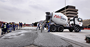
Even though blood also flowed in this Town during the 1914 Rebellion, there seems to be little evidence of it. The Silo in the middle of Town and next to the Station is the first vertical Silo to be built in the North West Province and is seen as a symbol of one of the richest maize growing regions in South Africa.